Vue lecture

Il y a de nouveaux articles disponibles, cliquez pour rafraîchir la page.
🔲 ☆

World Wide Whiteboard

We thought the Web was a library. Turns out it’s not. (Image via ChatGPT 4o.)

Before there were search engines, there were directories. The biggest and best-known was Yahoo. On the first graphical browser (Mosaic), it looked like this:

The directory idea made sense, because the Web is laid out like the directory in your computer. There is a “domain” with a “location” or a “site,” containing something after the last / in a path of /something/something/something. Geeks call these directories too, and the string of somethings a path. Directories in computing also follow an outline format: heads, subheads, and subheads of subheads.

While this design is boundlessly flexible, it also suggests durability, if not permanence, because it’s good to find stuff where it rightly goes and to find it in the same place over and over again.

That was what Yahoo assumed in the early days of the Web—as did everyone who bought a domain name. I’ve had searls.com since 1995. Dave Winer (father of outlining and progenitor of much else) has had Scripting.com for even longer (and has a lot more in that domain).

But we don’t own domain names. We rent them. And the World Wide Web isn’t a library. It’s a whiteboard with stuff written on it. Some of that stuff is located on directory paths. A lot more is coughed up by database systems on an as-needed basis.

The Yahoo directory failed. In its place search engines appeared. Search engines don’t catalog the Web like a library might. They index it. That means they send crawlers down the Web’s directory paths, recording everything they see into a searchable index. I explain here how that works and where this went:

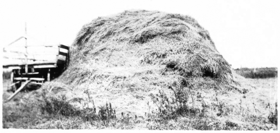
The Web is a haystack.

This isn’t what Tim Berners-Lee had in mind when he invented the Web. Nor is it what Jerry Yang and David Filo had in mind when they invented Jerry and David’s Guide to the World Wide Web, which later became Yahoo. Jerry and David’s model for the Web was a library, and Yahoo was to be the first catalog for it. This made sense, given the prevailing conceptual frames for the Web at the time: real estate and publishing.

Both of those are still with us today. We frame the Web as real estate when we speak of “sites” with “locations” in “domains” with “addresses” you can “visit” and “browse”—then shift to publishing when we speak of “files” and “pages,” that we “author,” “edit,” “post,” “publish,” “syndicate” and store in “folders” within a “directory.” Both frames suggest durability if not permanence. Again, kind of like a library.

But once we added personal movement (“surf,” “browse”) and a vehicle for it (the browser), the Web became a World Wide Free-for-all. Literally. Anyone could publish, change and remove whatever they pleased, whenever they pleased. The same went for organizations of every kind, all over the world. And everyone with a browser could find their way to and through all of those spaces and places, and enjoy whatever “content” publishers chose to put there. Thus the Web grew into billions of sites, pages, images, databases, videos, and other stuff, with most of it changing constantly.

The result was a heaving heap of fuck-all.*
Back in 2005, I wrote in Linux Journal about a split between the “static” Web that was like a library (with its “locations,” “sites,” and “domains” you could “visit” and “browse”), and the “live” Web of blogs and posts. Then social media came along, and the live branch of the Web outgrew the static Web’s trunk.

Last week came news that a leak revealed lots of interesting poop about how Google actually ranks search results. Here are two things I don’t need those leaked documents to tell me:

  1. Google favors the present over the past, the current over the archival.
  2. Google no longer indexes, or ranks very old Web pages.

I speak from experience here, because I have some old pages that are on the Web but don’t seem to be indexed, meaning searches don’t find them. I also have Easter eggs on a couple of those pages: words that exist in no language but made those pages easy to find when I did keyword searches for them. Now I get “No results found for _____.” (I won’t reveal the word because I want to keep testing Google.)

Countless publications have also come and gone on the Web without leaving a trace. Upside was a gigantic publication from the Nineties through the dotcom boom. Not a trace of it remains. Far as I know, nothing remains of Fast Company‘s early issues.

But hey, God bless the Internet Archive. Here’s a piece I wrote for PC Magazine in December 1982 about a PC application that taught card counting in blackjack:

As the evanescence of “content” increases, so does the importance of archives.

So maybe stop reading here and start reading here. We have a lot of work to do.

🔲 ☆

What symbolizes infrastructure best?

Which of these best says “infrastructure?”

I love studying infrastructure. I read about it (hi, Brett), shoot pictures of it, and write about it. Though not enough of the latter. That’s why I’ve started to post again at Trunk Line, my infrastructure blog.

A post there earlier today was about “dig safe” markings (aka digsafe and dig-safe). I ran it in part so I could create a cool new site icon (and favicon). If you’ve opened any link to Trunk Line, you’ll see its eight colors, like a flag for infrastructure itself, in the page’s tab.

But I’d like a title image that says infrastructure without explanation. The 36 images above were generated by Microsoft Bing’s Image Creator, using the prompt “A collection of images representative of infrastructure, including digsafe markings, a bridge, a high-voltage tower, a culvert, a road, a traffic light. Digital art.” Clearly it didn’t know what digsafe markings are, though Bing certainly does. (Wikipedia puts them under utility location.)

Do any of those work for you? Just wondering. Suggestions for other prompts, perhaps?

🔲 ☆

All home now

header images for three blogs

From 2007 until about a month ago, I wrote on three blogs that lived at blogs.harvard.edu. There was my personal blog (this one here, which I started after retiring my original blog), ProjectVRM‘s blog (also its home page), and Trunkline, a blog about infrastructure that was started by Christian Sandvig when he and I were both fellows at Harvard’s Berkman Center for Internet and Society (and which I kept alive with very occasional posts since then). The image above is from those blogs’ header images.

All three are now re-homed. This one is at doc.searls.com (a URL that had redirected to blogs/harvard.edu/doc for many years), ProjectVRM’s is at ProjectVRM.org (a URL that had redirected to blogs.harvard.edu/vrm address) and Trunkline’s (which had been at blogs.harvard.edu/trunk) is now at trunkli.org.

Their hosting service is Pressable.com, a WordPress subsidiary that worked with the Berkman Klein Center to make sure that every link on the Web pointing to pages at those three Harvard-hosted blogs now goes to those pages’ new locations, without anything being 404’d. Which is just. freaking. awesome.

My thanks and gratitude to all the people who helped, both within those organizations and in my own network of friends. Together they demonstrate that the Web is a living archive and not just a whiteboard.

🔲 ☆

A look at broadcast history happening

When I was a kid in the 1950s and early 1960s, AM was the ruling form of radio, and its transmitters were beyond obvious, taking the form of towers hundreds of feet high, sometimes in clusters formed to produce directional signals favoring some directions over others. These were typically landmarks out on the edge of town, or standing oddly on salt bogs or farmland.

From my bedroom in New Jersey, not far across the Hudson from New York City, I could see the red lights on the tops of towers standing in the “Meadowlands” (we called them swamps then) with Manhattan’s skyline beyond.

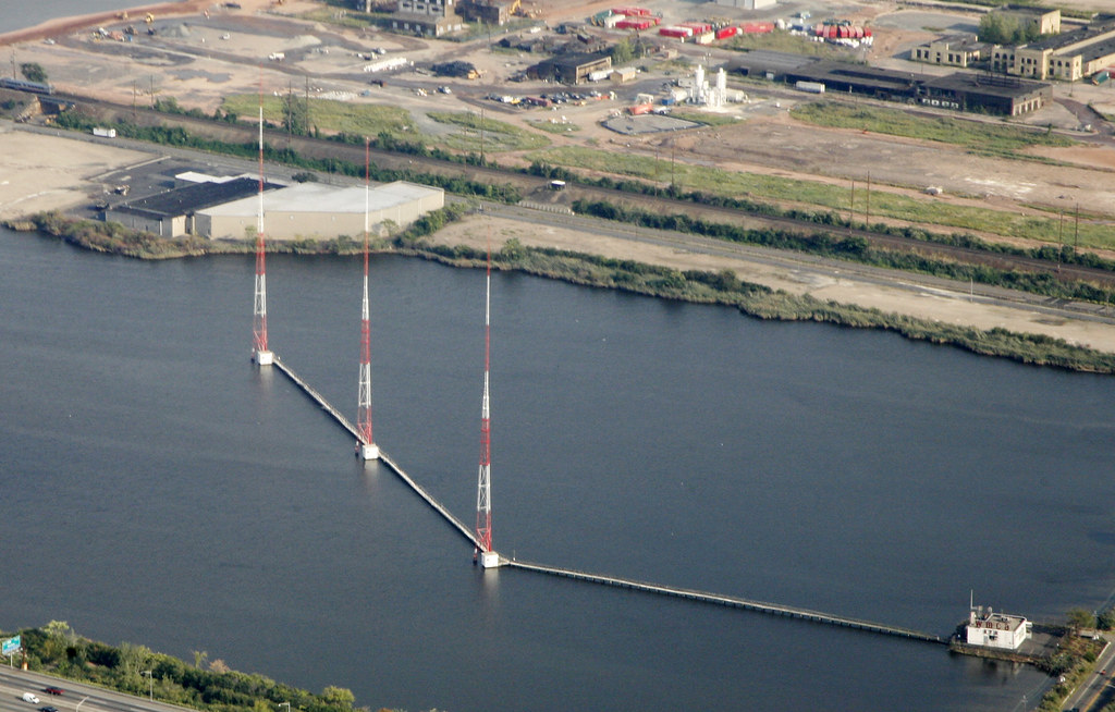
The towers in the photo above are three of those, tasked with beaming WMCA/570 and WNYC/820 toward New York’s boroughs from a pond of impounded water beside the Hackensack River and the east spur of the New Jersey Turnpike. Built in 1940, these three towers have by now become the most-seen AM radio signal source on Earth. For a while, they were also the most heard. That’s because, in its prime, which ran from 1958 to 1966, WMCA was also the leading top 40 music station in the world’s leading radio market. (WABC, with a signal ten times as strong, ruled the suburbs, with a night signal heard across half the country.)

While these days WNYC is the AM side of New York’s public radio empire (which brings in more money, largely from listeners, than any of the commercial stations in town), it is most famous for Mayor Fiorello LaGuardia’s “Talk to the People” show, which ran in the first half of the 1940s. (Back then WNYC had its own towers standing on what’s now WNYC Transmitter Park, alongside the East River in Brooklyn.)

Prior to the Internet, major media comprised a fewness of sources, in both print and broadcast. That fewness is over now, and the writing of over-the-air broadcasting’s end is being written on the Internet’s walls, perhaps most purposefully by yours truly. Because I’ve shot and shared thousands of photos of transmitters and antennas, knowing that the land under the most vulnerable ones—those on the AM band—tends to be worth more than the signals themselves. Many of these sites have already been sold off, with signals moving to shared towers on other stations’ sites, or just going dark.

Radio itself is also slowly being eaten alive: on the talk side by podcasts and on the music side by streaming services and webcasters. So I publish those photos as historical evidence of what in a few years (decades at most) will be no more. (Sorry, but no amount of lawmaking or regulation will save AM radio. Much as many of us—me included—still love it, neither the tech nor the economics can compete with the Internet, smartphones, the cellular system, and computers.)

So I recently ran a test of a theory: that it is good to have a conversation about all these developments, at least among professionals both active and retired in the broadcast engineering world. What follows is a post I put up for a private group that includes more than a dozen thousand of those.

Some hopefully fun detective work.

First, an ad in the November 14, 1949 issue of Broadcasting, the Youngstown-based company that built (or supplied steel) for countless AM stations in that band’s golden age. The image is of the array of six 400-foot tall self-supporting towers putting out the directional night signal for WFMJ, now WNIO/1390. HT for scanning and publishing that page goes to David Gleason, who gives us the amazing and valuable [https://worldradiohistory.com/](https://worldradiohistory.com/)

Second is a Google StreetView of what I think is the current view of the same site, with the transmitter shack and the six towers replaced. One of those is also a tower in WKBN’s own directional nighttime array. (Also, in the distance is another tower that appears not to participate in either station’s system.)

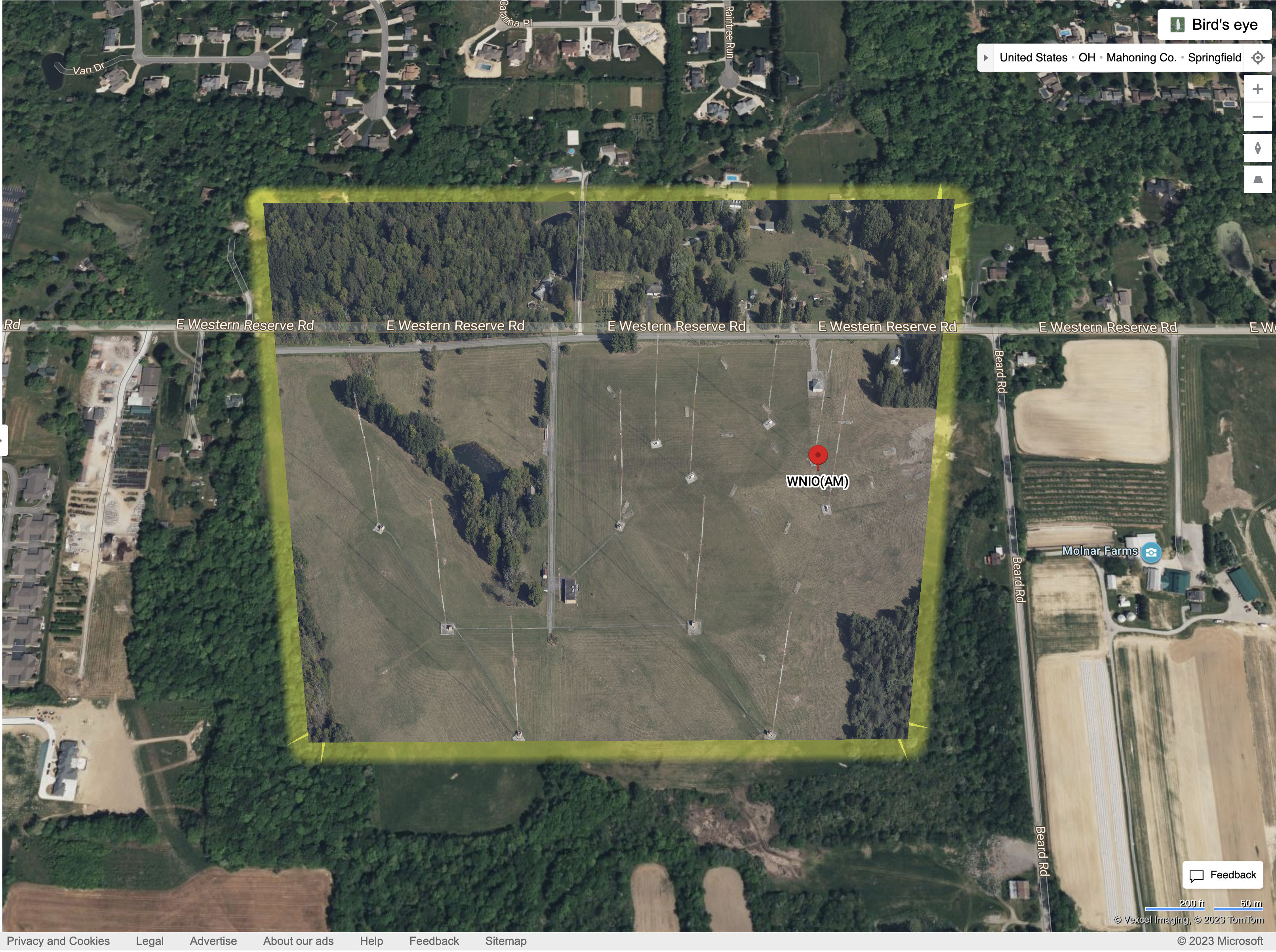
Third is a Bing Birds Eye (a fixed-wing aircraft) view of the whole site:

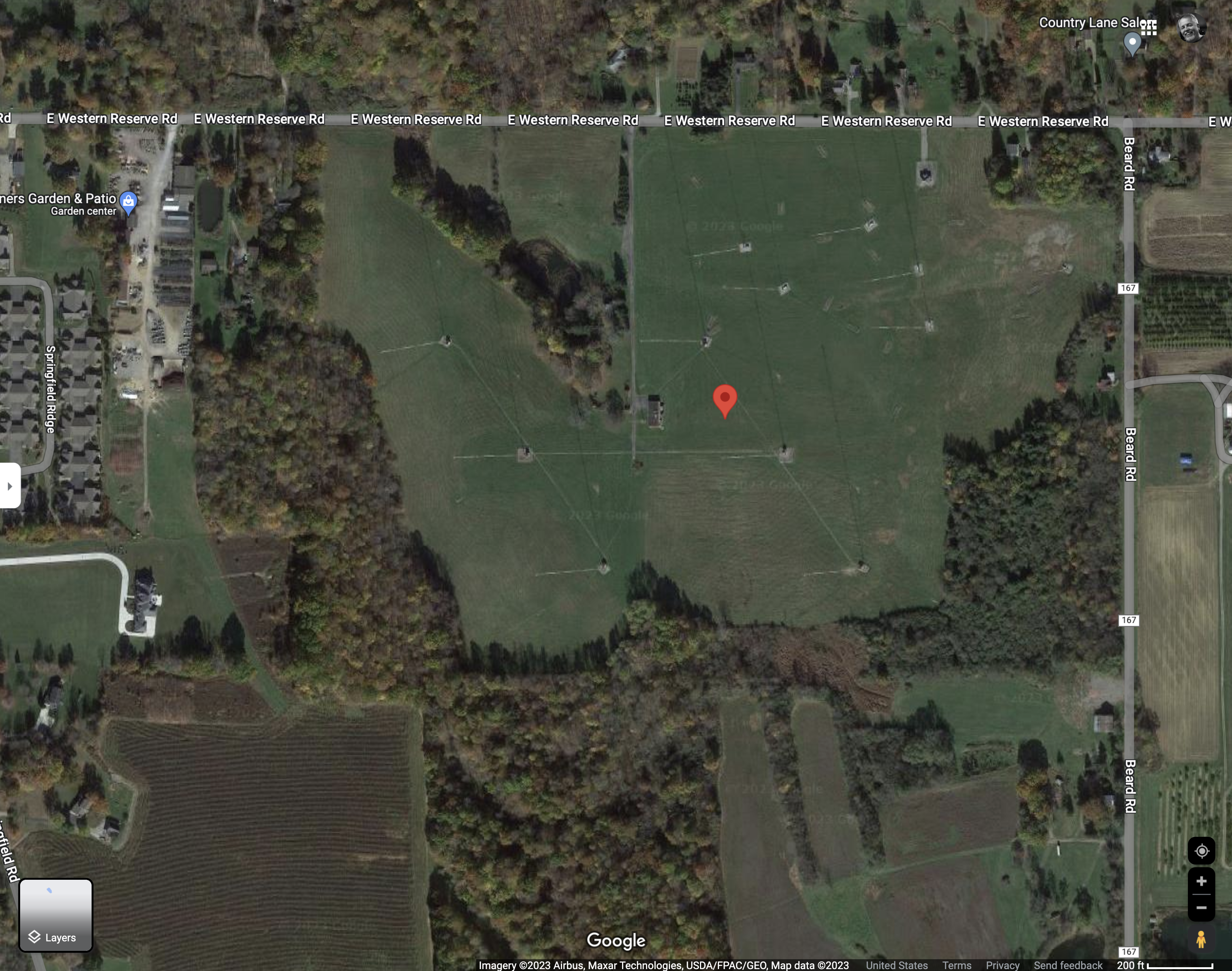
And a fourth is the Google view from space of the same.

Of possible relevance is that WNIO and WKBN are non-directional by day, the former from a tower at another site in town. Also that WNIO was a 5kw DA-N from the site for most of its life and is now 9.5kw from the day site and 4.8kw from the night site we see in these images—and that its six towers have six different electrical lengths, ranging from 105.8° to 215.1°, apparently in slightly different positions on the ground. Also that WKBN has been 5kw day and night since the late 1940s.

We can also see from the Truscon ad that the original address of WFMJ was on Poland-Broadmans Road, which I think is now just Broad. (The current shack for WNIO is on East Western Reserve Road, while WKBN’s is at the end of a long driveway off that same road.) One can also see from above something of the entrance off broad and possibly something of the original footprint of the original tower layout.

So, some questions are:

1) Is the first photo from the entrance to the site in the Truscon ad?
2) When did WKBN show up, or was it already at this site?
3) Are the different lengths of towers in the current WNIO array the result of more efficient towers in it, and also why the 4.8kw signal roughly matches the old 5kw footprint on the ground?
4) In 1949, were six towers about the limit of what one could do with a directional array using long math, trig tables, and graph paper, and perhaps a record number for its time?
5) Was Truscon the outfit that pioneered narrow rather than fat towers, and ones with three sides rather than four?

There are other variables, of course. But I just enjoy this kind of detective work, and I’m kinda chumming the waters to bait others who like to do the same. Thanks in advance.

We’ll see who rises to the bait and with what.

[Later…] Old pal Scott Fybush pointed to one of his transmitter visit reports and added this:  “Summary: the current WNIO night site is not the original 1949 six-tower site. That was on what’s now Boardman-Poland Road (US 224) at what’s now the Shops at Boardman Park strip mall. It succumbed to development in the early 1990s, at which point 1390 moved to what’s now its current day tower. The current six-tower night array on Western Reserve Rd. was built in 2003, next to the 1977-vintage WKBN array. WKBN’s original DA was at the WKBN studios at 3930 Sunset, which is still the WKBN-TV facility.”

Given that radio’s content (as we now call it) is gone at the speed of short-term memory (unless it’s recorded, which mostly it isn’t), this kind of reporting may be the only history it has. So, if history matters, this kind of inquiry also matters.


The top photo is one of many I’ve shot on en route to EWR (Newark Liberty International Airport). By the way, these towers were built when one could walk on the land there. One needed boots and a scythe, but it was possible. The water was impounded in the 1990s, I think. Here are some shots from a visit to the site nine years ago.

🔲 ☆

Moving on

dead truck

I started this blog in August 2007 after the host for my original blog went away. (That blog has been preserved, however. Find it at http://weblog.searls.com.)

At the time I was told something like “Hey, Harvard has been around since 1636, so your blog will last a long time here.” Well, the duration will be a bit less than sixteen years: Harvard is shutting the server down on Friday. [Later: it didn’t.]

I just got this news here, in an announcement posted in March. I missed it until Rogers Cadenhead (@rcade) told me about it on Twitter. [Later: the announcement was put in an obvious place: in the blog’s dashboard header. I still missed it. Disclosure: sometimes the obvious is not apparent to me.]

So I am scrambling now, with the help of friends, to move the contents of this blog to a new place. Hopefully, that will be blog.searls.com or searls.com/blog or both. We’ll see. [Later: it landed here at doc.searls.com, which had been a redirect URL aimed for many years at blogs.harvard.edu/doc.]

Two other blogs I run—ProjectVRM and Trunkline—also need to be moved. ProjectVRM is the one that matters more. If all goes according to plan, projectvrm.org will map to the same blog in its own new place. Trunkline will go to trunkli.org. [Later: both of these are (as of early July 2023) in the midst of both staying where they are and moving elsewhere. ProjectVRM should appear at some point at projectvrm.org.]

Here are my final Harvard-hosted posts on ProjectVRM and Trunkline:

My thanks to the Berkman Klein Center for hosting these blogs for so many years, and for the amazing community it serves— and in which I remain a devoted member.


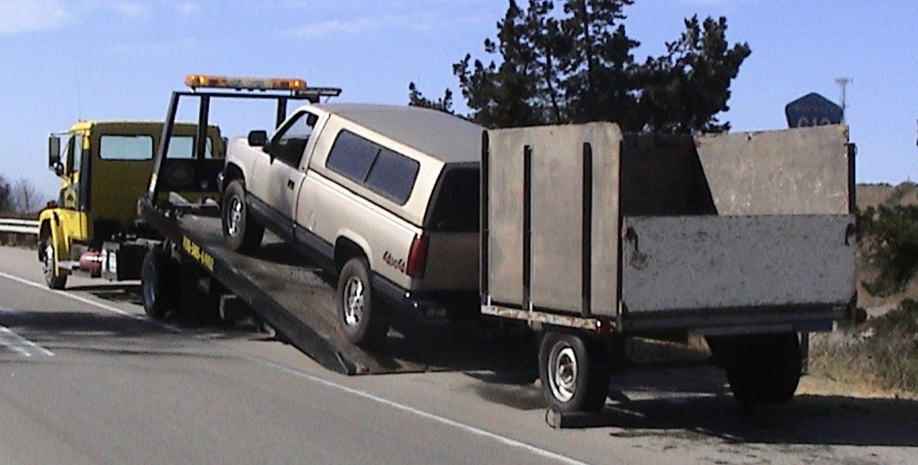
The image above is of a truck I borrowed being towed away after the engine blew up in King City, California, back in 2005. It’s not a good illustration of what’s going on, but the best I could do in a hurry. I’ll find a better one later.

☑️ ☆

Complexité, facilité et simplicité, un triptyque paradoxal qu’il convient de concilier

Complexité, facilité et simplicité, un triptyque paradoxal qu’il convient de concilier

Notre quotidien consiste à gérer la complexité en évaluant les impacts d’un nouveau composant ou d’une nouvelle version, en établissant un plan d’action pour une montée de version, en réagissant lorsqu’un changement provoque des conséquences imprévues. Cette complexité semble inhérente à n’importe quel projet, on le sait, comme une fatalité, avec le temps, un projet devient difficile à faire évoluer, et même à maintenir en condition opérationnelle.

Pour qu’un projet reste maintenable et conserve son potentiel d’évolution, il est nécessaire de tendre vers la plus grande simplicité. Cela semble évident au premier abord. On pourrait penser que chacun d’entre nous souhaite appliquer la solution la plus simple à un problème donné. En effet, il n’existe pas de raison de tendre systématiquement vers la complexité…

Malheureusement, penser que tout à chacun tende vers la recherche de la solution la plus simple, c’est commettre une erreur fondamentale, en confondant les notions de facilité et de simplicité. Tendre vers la solution la plus facile est une évidence biologique. Pour les animaux que nous sommes, économiser son énergie c’est favoriser sa survie. La facilité est une question d’effort alors que la simplicité est une question de conception que l’on pourrait définir par le fait d’avoir peu de composants et surtout peu de liens entre ceux-ci. Parfois, la solution la plus simple est aussi la plus facile. Parfois, en revanche ça n’est pas le cas.

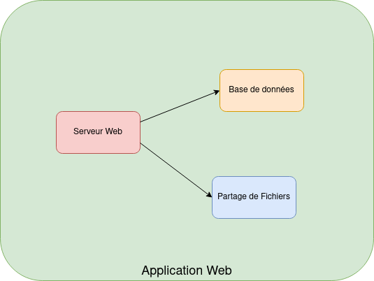
Nous pouvons citer un exemple où simplicité et facilité vont de pair : “l’architecture web classique”. Difficile de faire plus simple que de stocker les données dans une base de données et stocker la logique et l’interface dans une application.

Application 3 Tiers Classique

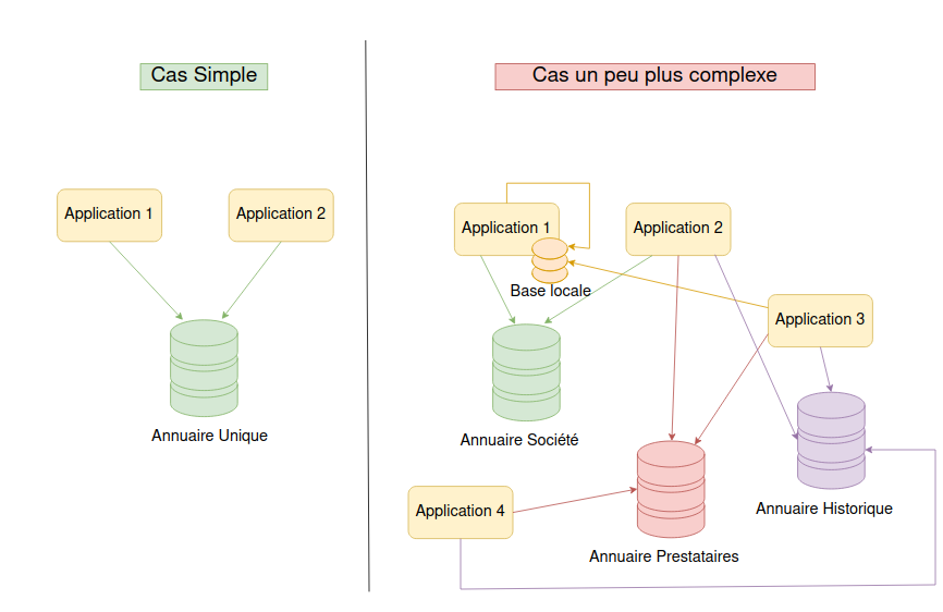
Un contre-exemple : je dispose d’une application sur laquelle les utilisateurs internes d’une organisation s’authentifient via un SSO, annuaire, ou autre. J’ai besoin qu’un prestataire extérieur puisse accéder à cette application. La solution la plus facile serait probablement de créer un compte local dans l’application à cet utilisateur, sans passer par un annuaire ou un SSO. C’est facile… mais ça n’est pas simple. On se retrouve dans une situation qui contraint à gérer le cycle de vie des comptes locaux. Le passage à l’échelle (plusieurs prestataires, plusieurs applications… ) va vite devenir une problématique forte.

La complexité vient de l’amoncellement de futures petites actions pour lesquelles la facilité est priorisée, car toujours urgentes, mais qui ne sont pas coordonnées et qui créent peu à peu de la lourdeur et irrémédiablement à la fois de la dette technique et un surcroît de gestion.

Cas des référentiels

Comment « faire simple »

Nous l’avons vu, la simplicité ne vient pas naturellement, y accéder demande de la discipline. Pour ce faire, voyons quelques angles d’attaque

  • Conception :

La simplicité d’un système se décide et se joue souvent dès la conception. Celle-ci doit favoriser le fait d’avoir peu de composants, qu’ils soient complémentaires (pour éviter les redondances qui dupliquent le travail de maintenance) et que leurs interactions soient peu nombreuses et bien définies (pour limiter les effets de bords dus à des interactions inconnues).

Dans un tel système, une petite équipe peut se concentrer sur un seul composant et n’a besoin d’interagir qu’avec les quelques équipes dont le composant dépend directement. La philosophie UNIX est l’exemple le plus connu de conception basée sur la simplicité (KISS). L’UNIX original comprend peu de commandes et d’appels systèmes et il y a peu de mécanismes d’interaction (descripteurs de fichiers, signaux).

  • Sobriété :

Difficile de faire plus simple qu’un système qui n’existe pas. Dès la conception, renoncer à certaines fonctionnalités marginales ou supprimer celles qui ne sont plus nécessaires, permet mécaniquement de réduire le nombre de composants, le volume de code ainsi que la consommation de ressources. A-t-on besoin d’implémenter un cas d’usage qui se produit une fois par an et qui peut être traité par un administrateur manuellement ? A-t-on vraiment besoin de stocker des données personnelles qui amènent avec elles leur lot de contraintes techniques et légales ? Est-il vraiment utile d’implémenter un système de remontée automatique d’alertes dans le nouveau logiciel alors que le monitoring en place le fait déjà ?

  • Extensibilité :

Le fait de pouvoir améliorer un système, qu’il s’agisse de sa modification directe ou via un système de plugin, permet souvent d’économiser un composant supplémentaire qui aurait servi de passerelle.

Exemple : un plugin permettant aux utilisateurs AD de se connecter à une application permet d’économiser la mise en place d’un batch d’import des utilisateurs, avec synchronisation des mots de passe, gestion des suppressions.

  • Interopérabilité et standards :

Favoriser le respect de standards établis et l’interopérabilité entre solutions permet de s’abstraire d’une technologie particulière. La dépendance à un fournisseur donné est ainsi réduite, mais ça n’est pas le seul avantage. Pouvoir remplacer un composant par un autre est indispensable à des fins de tests (bouchons, etc.) et renforce l’assurance qu’un composant testé en isolation fonctionnera comme attendu une fois intégré.

HTTP est un excellent exemple : de nouveaux usages de HTTP apparaissent constamment, facilités par le fait qu’il n’y a pas besoin de modifier les clients et les serveurs existants. Lorsque l’on développe un protocole basé sur HTTP, il n’est pas nécessaire de tester la gestion des connexions réseau par les bibliothèques qui implémentent ce protocole ; on sait que ça fonctionne.

  • Long terme :

On l’a vu, la simplicité est parfois à l’opposé de la facilité. Elle a donc parfois un coût de mise en œuvre plus important. Cependant, ce surcoût est vite rentabilisé, car l’équipe de maintenance reste de taille modeste, le projet reste facile à appréhender et les évolutions ont à la fois moins d’impact et restent plus faciles à tester.

  • Refactoring

On prend rarement, dans un projet, le temps nécessaire à la consolidation des différentes évolutions et notamment supprimer ce qui n’a plus lieu d’être. En d’autres mots faire du nettoyage. Les développeurs agiles parlent de réusinage/refactoring, une étape essentielle qui est très souvent négligée. Le refactoring s’applique en réalité à tous les domaines. Par exemple, si un load balancer a été installé pour le projet X, il ne faudra pas oublier de le supprimer si un load balancer mutualisé est mis en place plus tard.

Le salut via l’Open Source ?

Le fait que le code d’un logiciel soit ouvert ou non n’a pas une influence directe sur son caractère de “simplicité”. On trouve des logiciels simples et bien conçus mais privateurs et on trouve des amas de complexité à des codes parfaitement libres. N’insistez pas, nous ne donnerons pas d’exemples…

Keep It Simple Stupid

Pourtant le mode de développement communautaire de l’Open Source encourage la simplicité du design : de petites équipes, souvent peu coordonnées entre elles qui développent des solutions basées sur des standards d’interopérabilité. La bonne maintenance du logiciel est assurée par le fait que les développeurs ne disposent parfois que de ressources limitées, et la sobriété est garantie par le fait que bien souvent, c’est à celui qui désire une fonctionnalité de faire l’effort de l’implémenter. Gare à celui qui augmentera trop la complexité d’un logiciel existant en introduisant une nouvelle fonctionnalité, les mainteneurs seront particulièrement vigilants à ce que cela n’arrive pas, puisque justement, ce sera à eux que reviendra la tâche de la maintenir.

Conclusion

Nous sommes convaincus, peut-être que vous aussi maintenant, que la simplicité doit redevenir une priorité dans les projets informatiques. Cet effort sera récompensé par un gain de réactivité concernant les évolutions et apportera cohérence et maintenabilité sur le long terme. Un système d’information simplifié permet tout autant aux équipes d’alléger leur surcharge cognitive que de mieux anticiper les impacts de leurs actions.

“Faisons l’effort de faire plus simple !”

🔲 ☆

FM Stations Down on Gibraltar Peak

[Update: 11:20 AM Wednesday 18 January] Well, I woke this morning to hear all the signals from Gibraltar Peak back on the air. I don’t know if the site is on generator power, or if electric power has been restored. This pop-out from a map symbol on Southern California Edison’s Power Outage Awareness Map suggests the latter:

However, I am listening right now to KZSB/1290 AM’s FM signal on 96.9 from Gibraltar Peak, where the show hosts are detailing many road closures, noting that sections of Gibraltar road are “down the hill,” meaning not there anymore, and unlikely to be fixed soon. I think I also heard them say their FM transmitter is on generator power. Far as I know, they are the only station covering local road closures, buildings damaged, farms and orchards damaged, and related topics, in great detail. It’s old-fashioned local radio at its best. Hats off.

Looking at the power requirements up there, only two stations are high-power ones: KDB/93.7’s transmitter pumps 4.9kW into a stack of five antenna bays that yield an ERP (effective radiated power) of 12.5kW, and KDRW(KCRW)/88.7 uses about 5.9kW to produce 12kW ERP through a stack of four antenna bays. Those are on the poles at the right and left ends of this photo, which I shot after the Jesusita Fire in 2009:

All the other stations’ transmitters require less wattage than a microwave oven. Three only put out ten watts. So, given typical modern transmitter efficiencies, I’m guessing the site probably has a 20kW generator, give or take, requiring about 2.5 gallons of propane per hour. So a 500-gallon propane tank (a typical size) will last about 200 hours. Of course, none of that will matter until the next outage, provided electrical service is actually restored now, or soon.

[Update: 3:34 PM Monday 16 January] Two news stories:

  1. Edhat: Gibraltar Road Damage., by Edhat staff, Januraly 11, 2023 12:30 PM. It’s a collection of revealing Gibraltar Road photos that I wish I had seen earlier. Apologies for that. This is the text of the whole story: “A resident of Gibraltar Road shared the below photos from the recent storm damage. A section of the road appears to be washed out with a Tesla trapped under some debris. The Tesla slide is located approximately a quarter mile past the Rattlesnake Canyon trailhead and the washed road is about a mile past the radio tower before reaching the west fork trailhead.” If “mile past” means going uphill toward East Camino Cielo on the ridge, that means travel was (and is) impeded (at the very least) in both directions from the transmitter sites. The photos are dramatic. Please check them out.
  2. NoozhawkSeveral Radio Stations Still Off the Air After Storm Knocks Out Power to Gibraltar Transmitter Site by Giana Magnoli, by Managing Editor Giana Magnoli, January 16, 2023 | 1:47 pm

From the Noozhawk story:

  • “… they’ve helicoptered up a new battery and 600 gallons of diesel fuel to the site’s backup generator, but they haven’t been able to get it to work.” I believe this is for lack of the expected banjo valve. (See below.)
  • “Southern California Edison, which supplies power to the transmission towers site, first reported an outage for the Gibraltar Road area at 2:34 a.m. Jan. 9, the day of the big storm.” That was Monday. At least some stations would have switched over to generator power then.
  • “Repair crews haven’t been sent to the site yet, according to the SCE Outage Map, but Franklin said he heard there could be new poles installed this week.” That’s John Franklin, who runs the whole Gibraltar Peak site.
  • “KCLU (102.3 FM) went off the air on Wednesday and was still off as of Monday.KCLU (102.3 FM) went off the air on Wednesday and was still off as of Monday. KJEE (92.9 FM) went down for several days but came back on the air on Thursday.” Note: it’s not on now—at least not on the radios I’m using.
  • “Santa Barbara County spokeswoman Kelsey Gerckens Buttitta said there are cell and radio station towers off Gibraltar Road that requires fuel to operate, and Gibraltar Road and East Camino Cielo Road are closed because of slides, debris and slipouts.” Fixing those roads will be very difficult and time-consuming.

The story also lists signals I reported off as of last night. One correction to that: K250BS/97.9, which relays KTMS/990, is on the air. This I presume is because it’s at the KTMS/KTYD site. All the signals from that site (which is up the road from Gibraltar Peak) are still up. I assume that’s either because they are fed electric power separately from Gibraltar Peak, or because they are running on generator power.

[Update: 11:40 AM Monday 16 January] In a private group discussion with broadcast engineers, I am gathering that a stretch of Gibraltar Road close to the Gibraltar Peak site has collapsed. The location is 34°28’05.2″N 119°40’21″W, not far from the road into the transmitter site. This is not the section marked closed by Santa Barbara County on its map here. It is also not an easy fix, because it appears from one photograph I’ve seen (shared on a private group) that the land under the road slid away. It is also not the section where power lines to the site were knocked out. So we’re looking at three separate challenges here:

  1. Restoring electrical service to Gibraltar Peak, and other places served by the same now-broken lines
  2. Repairing Gibraltar Road in at least two places (the one marked on the county map and the one above)
  3. Getting generators fueled and fixed.

On that last issue, I’m told that the site with most of the transmitters can be powered by a generator that awaits what is called a banjo valve. The KDB facility requires propane, and stayed up longer than the others on the peak while its own supply held up.


Gibraltar Peak isn’t the highest landform overlooking Santa Barbara. At 2180 feet, it’s about halfway up the south flank of the Santa Ynez Mountains. But it does provide an excellent vantage for FM stations that want the least obstructed view of the market’s population. That’s why more local signals come from here than from any other site in the region.

Except for now: a time that began with the storm last Tuesday. That’s when power lines feeding the peak were broken by falling rocks that also closed Gibraltar road. Here is a list of signals that have been knocked off the air (and are still off, as of the latest edit, on Sunday, January 15 at 11:15PM):

  • 88.7 KDRW, which has a studio in Santa Barbara, but mostly relays KCRW from Santa Monica
  • 89.5 KSBX, which relays KCBX from San Luis Obispo*
  • 89.9 K210AD, which relays KPCC from Pasadena by way of KJAI from Ojai
  • 90.3 KMRO-FM2, a booster for KMRO in Camarillo
  • 91.5 K218CP, which relays KAWZ from Twin Falls, Idaho
  • 93.7 KDB, which relays KUSC from Los Angeles (down after running on generator power for 5 days)
  • 96.9 K245DD, which relays KZSB/1290 AM in Santa Barbara
  • 97.9 K250BS, which relays KTMS/990 AM in Santa Barbara (and is on a KTMS tower, farther up the slope)
  • 98.7 K254AH, which relays KPFK from Los Angeles
  • 102.3 KK272DT, the FM side of KCLU/1340 in Santa Barbara and KCLU/88.3 in Thousand Oaks

KTMS/990AM, KTYD/99.9FM, and K231CR/94.1, which relays KOSJ/1490AM, are still on the air as of Sunday night at 11:15pm. Those are are a short distance farther up Gibraltar Road. (In the other box in the photo above.)

Here is a guide to substitute signals for some of the stations:

  • KCRW/KDRW can be heard on KCRU/89.1 from Oxnard (actually, Laguna Peak, in Pt. Magu State Park)
  • KDB can be heard on KDSC/91.1 from Thousand Oaks (actually off Sulphur Mountain Road, south of Ojai)
  • KCLU can be heard on 1340 AM from Santa Barbara and 88.3 FM from Thousand Oaks
  • KPCC can be heard on KJAI/89.5 from Ojai (also transmitting from Sulphur Mountai Road)
  • KSBX/KCBX can be heard on 90.9 from Solvang (actually Broadcast Peak)
  • KPFK can be heard on its home signal (biggest in the U.S.) from Mount Wilson in Los Angeles at 90.7
  • KZSB can be heard on 1290 AM from Santa Barbara
  • KMRO can still be heard on its Camarillo main transmitter on 90.3

The two AM signals (marked green in the top list above) are strong in town and most of the FMs are weak but listenable here and there. And all of them can be heard through their live streams online.

Published stories so far, other than this one:

The Independent says the site is a “relay” one. That’s correct in the sense that most of the stations there are satellites of bigger stations elsewhere. But KCLU is local to Santa Barbara (its anchor AM station is here), and the ratings reflect it. I wrote about those ratings a few years ago, in Where Public Radio Rocks. In that post, I noted that public radio is bigger in Santa Barbara than anywhere else in the country.

The most recent ratings (Spring of 2022), in % shares of total listening, are these:

  • KDB/93.9, classical music, relaying KUSC/91.1 from Los Angeles: 7.9%
  • KCLU/102.3 and 1340 in Santa Barbara (studios in Thousand Oaks), public broadcasting: 7.3%
  • KDRW/88.7 in Santa Barbara (main studio in Santa Monica, as KCRW/89.9): 4.6%
  • KPCC/89.9, relaying KJAI/89.5 and KPCC/89.3 in Pasadena: 1.3%
  • KSBX/89.5, relaying KCBX/90.1 from San Luis Obispo: 0.7%

Total: 21.8%.

That means more than a fifth of all radio listening in Santa Barbara is to noncommercial and public radio.

And, of all those stations, only KDB/KUSC and KCLU-AM are on the air right now.

By the way, when I check to see how public broadcasting is doing in other markets, nothing is close. Santa Barbara still kicks ass. I think that’s an interesting story, and I haven’t seen anyone report on it, other than here.


*Turns out KSBX is off the air permanently, after losing a coverage battle with KPBS/89.5 in San Diego. On December 29, they published a story in print and sound titled Why is 89.5 KSBX off the air? The answer is in the atmosphere. They blame tropospheric ducting, which much of the time makes KPBS come in like a local signal. Also, even though KPBS’s transmitter on Soledad Mountain (really more of a hill) above the coast at La Jolla is more than 200 miles away, it does pump out 26,000 watts, while KCBX puts out only 50 watts—and less in some directions. Though the story doesn’t mention it, KJAI, the KPCC relay on 89.5 for Ojai, is audible in Santa Barbara if nothing else is there. So that also didn’t help. By the way, I’m almost certain that the antenna identified as KSBX’s in the story’s photo (which is also one of mine) is actually for KMRO-2. KSBX’s is the one on the left in this photo here.

❌